| Approaches |
||
| Home
Abstract Project Motivation Coastal Environment
|
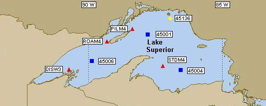
Lake Superior wind-wave data was obtained
from the National Oceanic and Atmospheric Administration (NOAA) and the
National Weather Service (NWS) National Data Buoy Center (NDBC) -Station
45006 W Superior 48 NM North of Ironwood, MI.
http://www.ndbc.noaa.gov/Maps/WestGL.shtml This data included information such as air temperature, surface water temperature, wind speed and direction, significant wave height, average and dominant wave periods, as well as other meteorologic data. Buoy data was used from June, July, August, and September 2003. Since northwesterly winds dominate the Lake, only time periods when northwesterly winds were occurring were used and a variety of wind speeds were analyzed in order to compare the effect of wind speed and wave formation on bottom sediment resuspension. Some facts about sediment resuspension and transport:
Below is a summary of the equations and assumptions used to perform this wind-wave-sediment analysis. Given the offshore buoy data which includes water depth, significant wave height, wave period as well as wind direction and magnitude of wind speed.
Then by the Conservation of Wave Power (assuming no bottom friction), wave heights could be calculated at varying water depths for the different wind speeds, as well as whether or not the wave would be breaking. To simplify the wave system, it was assumed that the only wave transformation was shoaling, that there was no wave refraction, diffraction, or reflection.
In order to determine whether or not materials would resuspend, the system was greatly simplified. Resuspension of particles occurs when the forces due to waves and currents exceeds the critical shear force needed for the movement of the sediments. Several assumptions were made including that stamp sand particles are non-cohesive. To address the exceedence of the critical shear, the bottom orbital velocity (Uw) was calculated as well as the threshold orbital velocity (Ucr).
To apply the above equations, it had to be determined whether or not the water at the given location was “sufficiently shallow”. The following equation was used to confirm that. In all cases where this equation was applied, the water was categorized as sufficiently shallow.
Because a particle size distribution of stamp sand could not be found, a variety of particle diameters were analyzed, ranging from 10μm to 1000μm because stamp sands vary from very coarse particles to fines. Particle density was assumed to be 2025 kg/m3, and the kinematic viscosity and density of water was assumed to be at 10° C and 0ppm salinity. Using an Excel spreadsheet, it was determined if the bottom orbital velocity exceeded the threshold orbital velocity for each particle diameter at the varying wind speeds (wave heights). Iterations were performed so that the depth for particle resuspension due to waves was within a tenth of a meter. Charts were made summarizing the results of the analysis as well as plots showing the approximate zones of resuspension on a bathymetric map of Lake Superior.
|