Wave Processes on Lake Mendota
Madison,
Wisconsin
Wave Generation:
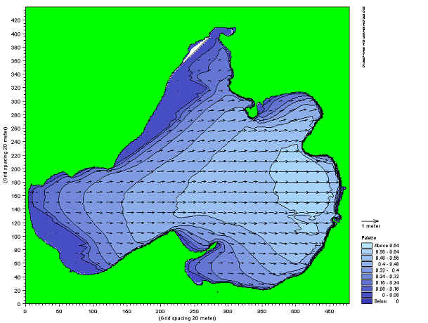
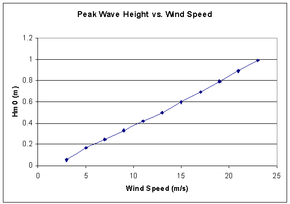
Waves were generated using the method of JONSWAP. For a given wind speed and direction, the resulting wave height is calculated by the model. Shown above is a run with a west wind (from left to right) of 15 m/s. This is a representative serious storm in the Madison area. The model shows that areas with the longest fetch (the eastern edge of Lake Mendota), result in the highest wave height. Note that areas behind headlands, therefore result in smaller waves. Before the wave hits the shoreline it begins to shoal and break. This grid is too coarse to simulate that effectively so a tighter grid needs to be implemented in those areas (as shown later). The model was run with a range in western wind speeds to understand the effect of wind on the peak wave height found on the lake. Results are shown below. A linear relationship between wind speed and peak wave height along the lake is observed.
Author: Chris Petykowski
Date: Dec 20, 2001
****The computer model used in this project is the MIKE 21 Nearshore Wave Module, produced by Danish Hydraulik Institute. All results are preliminary in nature, have not been verified extensively and are NOT intended for any use by others.