Water resources is essential for socio-economic development and for maintaining healthy ecosystems. In Dane County, Wisconsin, waters are precious and important for recreational activities, aesthetics, and defining the sense of place for residents and community. The growing of human population and rising levels of socioeconomic development have led to a rapid rate of water resource development and the replacement of naturally occurring and functioning systems with highly human-engineered systems. Meeting the needs for freshwater provisioning services has come at the expense of inland water ecosystems (rivers, lakes, and wetlands) that contribute to human well-being through recreation, scenic values, maintenance of fisheries and biodiversity, and ecosystem function. The grand challenge is to balance these competing demands by agreeing and determining ecosystem water requirements involving a societal decision of the desired condition of an ecosystem informed by data on the relationship between water resources and ecosystem services, and followed by a cognitive or technical response to determine the water quantity and quality necessary to meet articulated/consensus objectives. Furthermore evidence shows that climate change would impact the water cycle, affecting the vulnerability of water resources. Sustainable water resources management aims at optimizing the available water resources by applying (or developing) technologies, processes, and tools to increase the overall productivity of water for society.


Yahara Lakes River Chain System Water Level Orders/Regulation
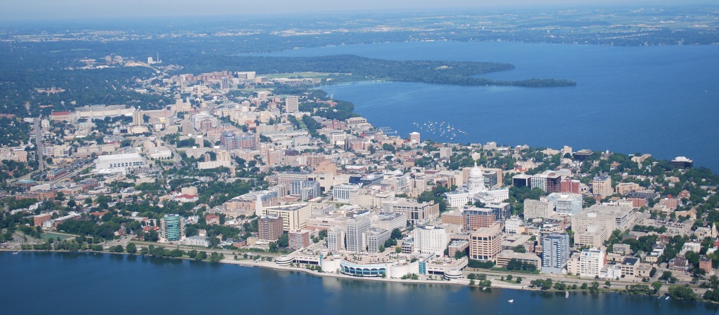
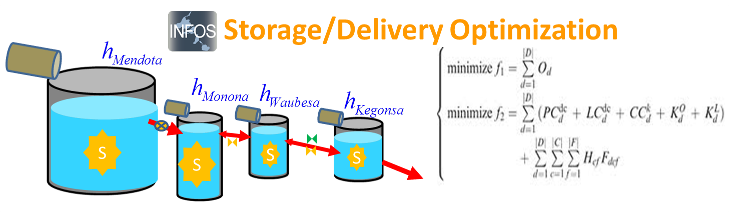
The optimal water level, the most controversial and debated issue, is critical for managing a chain of four lakes including Lakes Mendota, Monona, Waubesa, and Kegonsa, and their tributaries. Lake Mendota water levels are regulated by the Tenney Dam, which was constructed in 1847. The dam raised the original water level by 4.5 feet. Outflow from the Tenney Dam enters Lake Monona and travels through the Yahara River to Lake Waubesa. The Babcock Lock and Dam, located at the outlet of Lake Waubesa, regulates water levels for Lakes Monona and Waubesa. Lastly LaFollette Dam controls the water level of Lake Kegonsa. Furthermore, water level in each lake can be affected by connected river flow conveyance restricted by bridges, bottom roughness (boulders), aquatic vegetation, and sedimentation. Currently, regulatory limits on allowable lake levels are ordered by the Wisconsin Department of Natural Resources. These regulations establish maximum levels for the lakes for the entire year and two seasonal (winter and summer) minimum lake levels, determined by the competing but debatable demands of ecosystem services for each lake. To date it is unclear the optimal water levels among the Yahara Lakes that balance among economic growth with the preservation of ecological integrity, biological diversity, and social equity of all community members. No information regarding anticipation and adaptation for Yahara Lakes River Chain System response to extreme storm/drought events or changing climate is available. Through a variety of public/private partnerships, we are developing a Sustainable Integrated Modeling Observation Network (SIMON) for managing water levels.
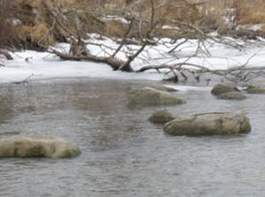
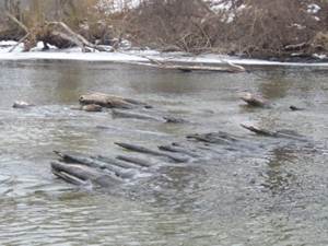
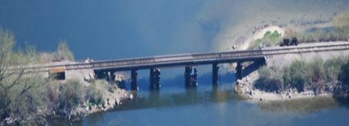
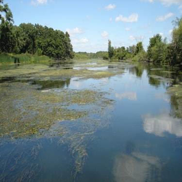
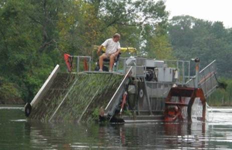
Archeological Fish Weir Historic Corduroy Bridge Railroad Trestle Constriction River Vegetation Growth River Weed Cutter
The Integrated Nowcast and Forecast Operation System (INFOS) for the Yahara Lakes provides real-time observed and modeling water information including water level, discharge, temperature, and other meteorological conditions. Comprehensive hydrologic/watershed and hydraulic models are incorporated to faithfully characterize Yahara Lakes and river chain system response to short-term weather events and long-term climate change. An interdisciplinary team is working to integrate real-time/future observations into models to depict/predict and display the spatial information of waters through a web browser. Currently we are assessing and developing the water level managing strategies for the Yahara lakes.
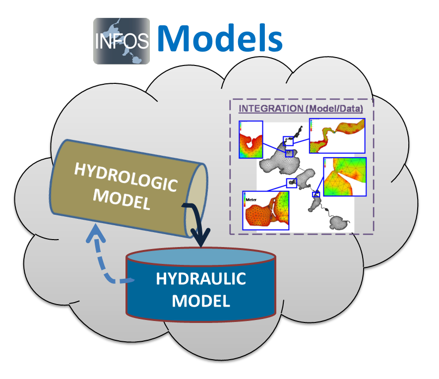


MODELS OBSERVATIONS INFRASTRUCTURE INTERFACE
A decision support system for managing a multi-purpose reservoir system consisting of a chain of lakes and rivers is needed. In particular, the Yahara Lakes comprise with a pre-determined operating lake levels as defined by the regulating agency. These man-made facilities such as reservoirs need to be operated in a manner to smooth out extreme inflows and to mitigate natural disasters, such as floods and droughts. Many complexities exist on how to predict the operation of hydraulic control structures that may affect not only its supported reservoir water level but also the downstream waters in a chain system. Tools are needed to support the operational decisions of lake management to reduce the risks of flooding and supplement daily operations. To predict flooding, supplement operational decisions, or address management scenarios for water quantity, our understanding of the water movement through the lakes and rivers and the predictive capability of inundation levels must be apparent. To improve our ability to better predict river delivery and lake storage, an operational water information system is crucially needed. Another on-going research is the development of a delivery/storage, optimization procedure using models and observation to assist in dam operations. In the past, managers use heuristic approaches including rule curves, operator judgment, and other qualitative information. Thus to guide operations to smooth out the impact of extreme events and prepare for forthcoming events, it is critical to recognize and evaluate the storage capacity and conveyance/delivery. In addition to storage and delivery, optimizing lake and river operations is necessary to minimizing flooding risks and minimizing undesirable environmental impacts. One of our research goals is to develop an optimal water management procedure that would contain a mechanism for guiding day to day lock/dam decisions within the framework of the regulatory operating criteria while recognizing the system storage and delivery.
Sponsor : Dane County Land and Water Resources Department
City of Madison
Wisconsin Department of Natural Resources
NSF
Yahara Lakes Water Level Advisory Group (YLAG2)
Yahara Lakes Association
Status : Active
Student Investigators:
John Reimer (PhD)
New (MS or PhD) students Openings
Graduated:
Biyun Sheng (MS), William Kasch (MS), Hoi Lai Tseung (MS), John Reimer (MS)
Collaborators:
Director Kevin Connors, Dane County Land & Water Resources
Professor Ken Potter, CEE, UW-Madison.
Mr. Greg Fries, City of Madison
Ms. Sue Josheff, Wisconsin Department of Natural Resources
Publications
- Reimer,
J.R. and Wu, C.H., Development and Application of a
Nowcast and Forecast System Tool for Planning and
Managing a River Chain of Lakes, Water Resources
Management, , doi
10.1007/s11269-016-1228-7, 2016.
- 2018
Task Force, Yahara Lake Level Recommendations.
- Yahara
Lakes Water Level Advisory Group (YLAG2), Dane
County Land & Water Resources Department, 2012.
- Hoi
Lai Tseung, Characteristics of Extreme Flow in the
Cherokee Marsh and the Upper Yahara River, Master
Thesis, Civil and Environmental Engineering,
UW-Madison, 2012.