
![]()
![]()
![]()
CEE 514: Coastal Engineering
Fall 2005
Professor Wu
Background Information
Dredging
Analysis & Results
Conclusion
Additional Pictures
References
The Sheboygan River Area of Concern:
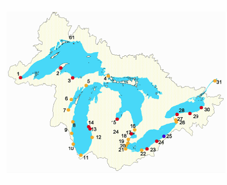
As a result of the 1987 Amendments to the Great Lakes Water Quality Agreement, the International Joint Commission identified the lower 14 mile section of the Sheboygan River as a Great Lakes Area of Concern (AOC), labeling this area as one of 43 contaminated sites in the Great Lakes drainage basin. The Sheboygan River Area of Concern refers to the area of the lower Sheboygan River that spans from the Sheboygan Falls Dam until it empties out into Lake Michigan in the Sheboygan Harbor. An Area of Concern is defined as a “place where beneficial uses of water resources such as drinking, swimming, fishing and navigation are impaired by anthropogenic pollution or perturbation.” Of the 43 AOC’s that span more than 2,000 miles of shoreline, 42 are considered impacted by contaminated sediments. Figure 1 below shows some of the primary AOC’s surrounding the five Great Lakes and their remediation futures.
In May 1999, the U.S. Environmental Protection Agency issued a cleanup plan to address the Sheboygan River and Harbor. The plan divides the river into five sections: (1) upper river, (2) middle river, (3) lower river and harbor, (4) floodplain adjacent to the river, (5) groundwater near Tecumseh plant in Sheboygan Falls. Figure 2 is a map showing the path of the river as it meanders into the Sheboygan Harbor and the respective sections identified by the U.S. EPA. (Figure 2).

Figure 2: Map showing the path of the Sheboygan River from Sheboygan Falls to Lake Michigan and identifying the five sections of the river as proposed by the cleanup plan. Retrieved from http://www.greatlakes.org/elimination/sheboygan08.asp
The following excerpt is taken from the Alliance for the Great Lakes website as part of a summary of the proposed remediation methods for each portion of the Sheboygan River AOC.
What is the contaminated sediment?
Sedimentation is the movement of the soil and other materials at the bottom of lakes, rivers and streams. This movement typically occurs naturally and has only recently become a problem due to industrial and urban development. This development results in runoff from streets, parking lots and farms, wastes discharged from pipes and pollutants released into the air. Because of this pollution, the sediments now contain dangerous levels of chemicals, toxins and metals that eventually make their way into other bodies of water.
A major source of sediment contamination into Lake Michigan is its abundant tributaries. Much of the contamination is a direct result of industrial discharge along these rivers. The EPA has identified three major contributors to contamination. These are polychlorinated biphenyls (PCB’s), polynuclear aromatic hydrocarbons (PAH’s) and heavy metals (lead, zinc, copper and chromium). PCB’s are particularly difficult to remove because of their ability to successfully move through the food chain. Just as in humans, PCB’s accumulate in the body fat of fish. As a result, a do not eat advisory is in effect for the Sheboygan River. This advisory includes carp, walleye, smallmouth bass, catfish, northern pike, bluegill and crappie. An advisory is also in effect not to consume any waterfowl obtained between the Sheboygan Falls Dam and the harbor. Additionally, populations of small game including mink have become increasingly small. Effects of prolonged exposure of PCB’s to humans include liver damage, cancer and developmental problems amongst children.
Sources of Contamination:
Three main sources of contamination have been identified:
1. Tecumseh Products Company
2. Kohler Company Landfill
3. Former gas plant facility from the late 1800's
Tecumseh is a manufacturer of refrigeration and air conditioning compressors and gasoline engines. The plant is located in Sheboygan Falls along the Sheboygan River. In 1978 they were found to be releasing PCB's through a sewer line that leads out into the river. This along with hydraulic fluids used in Tecumseh's die-casting process are believed to be the source of the high concentration of PCB's around the site. Recently, the Environmental Protection Agency has reached an agreement with Tecumseh for the proper clean up of some of the contaminated sediments. Approximately 5,000 cubic yards of contaminated sediment were removed from the Sheboygan River between 1989 and 1991. The agreement states that Tecumseh will pay $2.1 million to cover past costs and will financially guarantee to be responsible for the remaining cleanup of four miles along the river at a cost of $28 million.
The Kohler Company Landfill is not only a source of contamination of the Sheboygan River, but has also been declared a Superfund site. The landfill has been leaking contaminants into nearby groundwater. The landfill has been in operation since 1950 and is where foundry sand and pottery waste are disposed of. It is the source of a number of heavy metal pollutants including chromium, cadmium, lead, copper, antimony and zinc. A perimeter drain has been constructed around the site. The runoff from the drain carries polluted water to the Sheboygan Wastewater Treatment Plant and the site continues to be monitored.
The Wisconsin Public Service Corporation is the responsible party for contamination from a coal gasification plant along the Sheboygan River that operated from 1880-1930. Contamination from this site includes runoff such as tars and leakage from what were once underground tar tanks. The presence of PAH's downstream near Pennsylvania Avenue have been attributed to the former plant site.
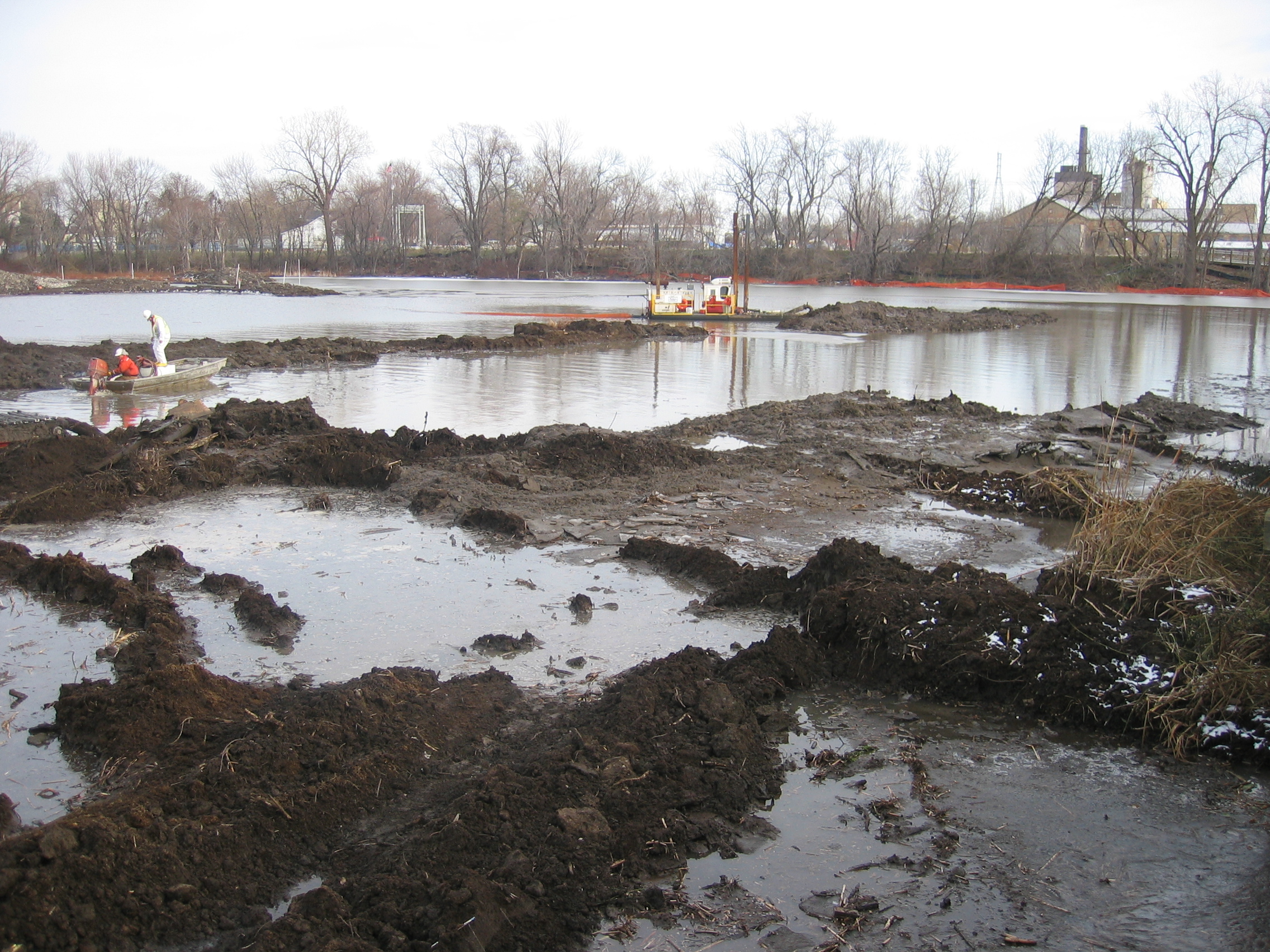
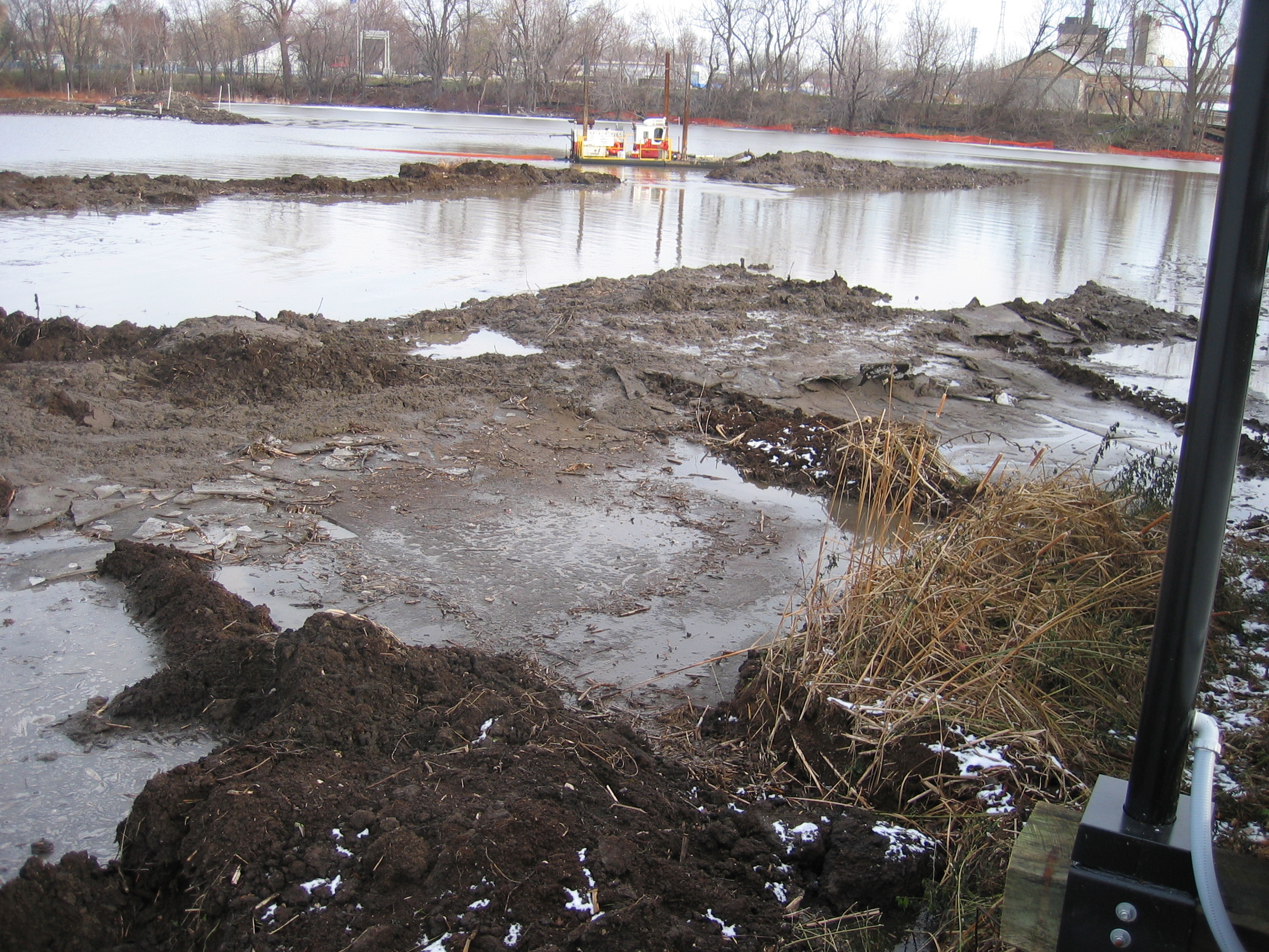
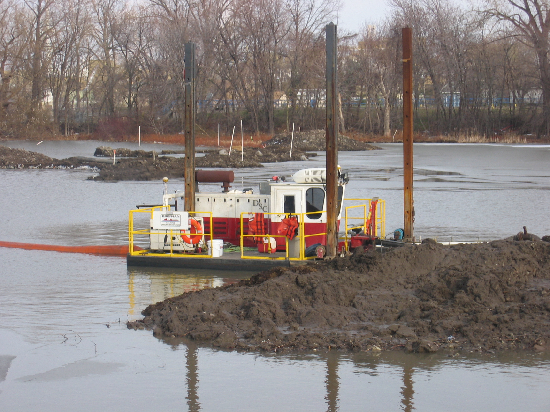
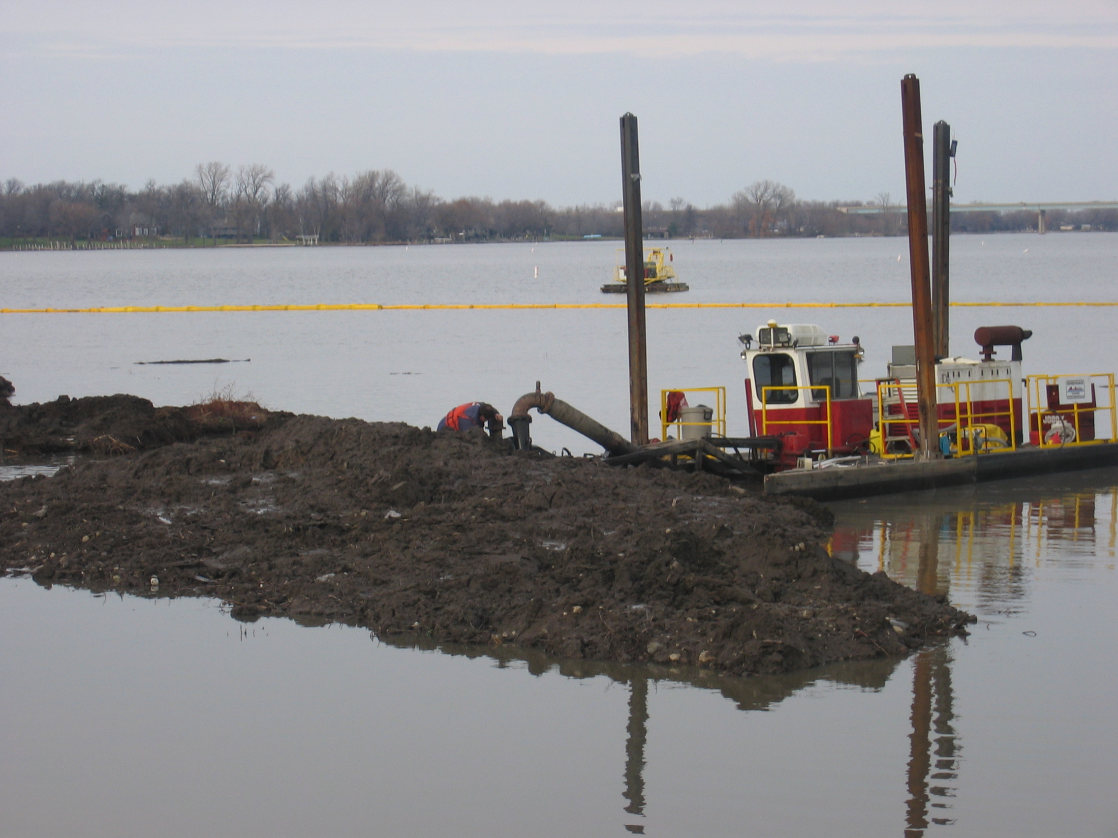
As is the case in most areas of contaminated sediment, the solution of choice is dredging. Dredging involves the digging and removal of layers of contaminated sediment. Depending upon how thick the contaminated layer is, it is sometimes necessary to fill in the dug out areas with clean sediment. The Sheboygan Harbor will be dredged to a depth of 14 feet and then covered with 2 feet of clean sediment. Along a half mile stretch, approximately 100,000 cubic yards will be removed along the lower river.
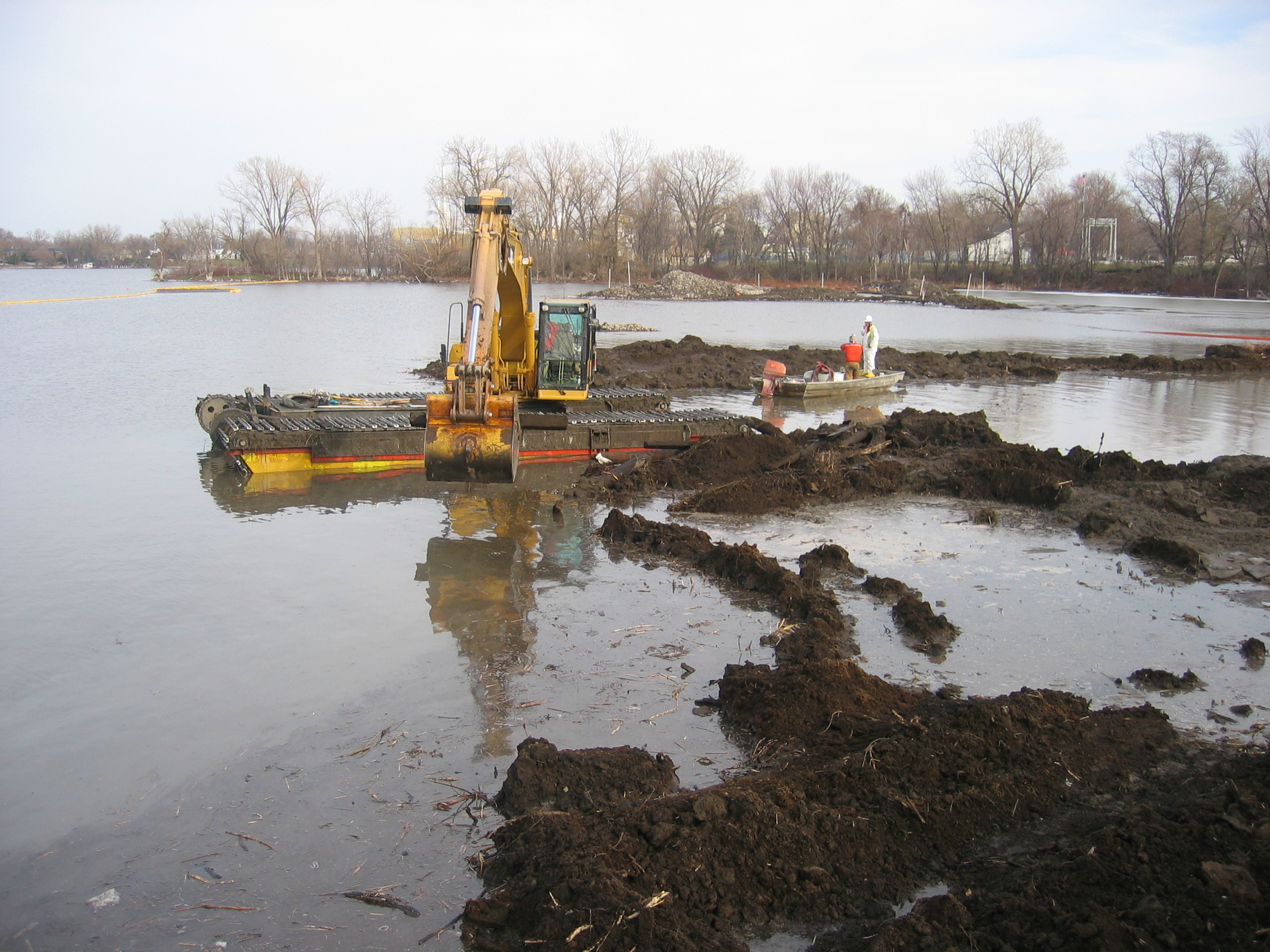
Another example of dredging contaminated sediments is currently underway between Neenah and Appleton, Wisconsin. The Little Lake Butte des Morts has been contaminated by runoff from nearby paper mills resulting in high concentrations of PCB's along the lake's bottom. The goal of the project is to reduce levels of PCB's in the lake to decrease exposure to fish. After the sediment is dug up it is piped to a staging area where the sediment is separated from the water. The water then undergoes treatment similar to that of a water treatment plant before it is released back into the lake. The separated sediment is disposed of in a licensed landfill that is designed to hold such sediment. A number of photographs of the dredging and pumping process can be viewed at the bottom of the web page. Photos
The goal of my project was to analyze the bottom velocities within the inner Sheboygan Harbor. The bottom velocity refers to the speed at which suspended particles can move along the bottom of a body of water. I used the JONSWAP Method to look at the effect of wind-induced waves on bottom velocities. As was stated in a report by the EPA, the concentration of contaminated sediments decreased from the inner harbor to the outer harbor. I hypothesized that this was because bottom velocities would reduce as water depth increases. Eventually, at some depth contaminants will cease to move except under long and powerful wind events.
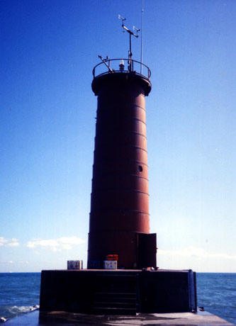
The JONSWAP Method is a way of hind casting, the determination of past wave height and bottom velocity conditions. To use this method, I needed to find data on wind velocities, wind durations, and wind directions. This data was found through the NOAA website which has a data recording station at the Sheboygan Lighthouse (SGNW3). Photo I took data from a 15 day period in June of 2005. A brief description of the equations used for the JONSWAP Method can be found below:

I imported the wind data into Microsoft Excel to complete the JONSWAP Method. The result was a plot that depicts bottom velocities versus time with a number of separate curves. Each curve represents a different depth (d2 has a depth of 2 meters, d15 has a depth of 15 meters, etc.). As was hypothesized, as the depth of the harbor increases, bottom velocities decrease. Once a depth of 15 meters was reached many of the bottom velocities approached zero. However, since some of the wind events were longer and more intense, the corresponding bottom velocities were not yet zero. However, one can conclude that the majority of sediments will cease to move along the lake bottom at a depth of 15 meters. Even though there may be wind events that are capable of transporting contaminated sediment, they are few and far between. The Microsoft Excel plot below (Figure 3) depicts my results.

Figure 3: Plot showing the relationship between depth and bottom velocities as they varied over a 15 day span in June 2005.
My analysis using the JONSWAP Method was very much simplified. By using this method, I assumed that all waves were wind induced and propagated in the same direction. Also, because of programming limitations, I was only able to take into account four wind directions (north, south, east, west). In reality the wave motions are not the only variable controlling the dispersion of sediments in the harbor. The flow of the river interacts with the waves that are moving towards shore to make the path of sediments much more complicated that just moving in one direction at a velocity that only varies with wave height, wave period and depth. More accurate results could be obtained if a longer period of time, such as several months or even years was studied.
Dredging at Little Lake Butte des Morts in Neenah, WI:

Sheboygan Lighthouse (NOAA Station SGNW3):

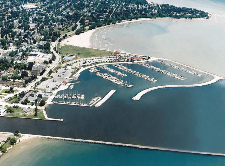
Sheboygan Harbor, Breakwater and Sheboygan River:


Adriaens, Peter, et al. "Great
Lakes Sediments: Contamination, Toxicity and Beneficial Re-Use." September 2002.
Retrieved from:
http://www.sediments.org/glsedi.pdf#search='sheboygan%20sediment%
20contamination'
Bergquist, Lee. "PCB cleanup begins at contaminated sites." September 14, 2004. Retrieved from: http://www.jsonline.com/news/state/sep04/258941.asp?format=print
Hummer, John. "Sheboygan River Area of Concern." August 22, 2001. Retrieved from: http://www.epa.gov/glnpo/aoc/sheboygan.html
Litke, Eric. "Sheboygan River PCB's examined." July 13, 2005. Retrieved from: http://www.wisinfo.com/sheboyganpress/news/archive/local_21786823.shtml
Muno, William E. "U.S. EPA
Superfund Record of Decision: Sheboygan River and Harbor." May 12, 2000.
Retrieved from:
http://www.epa.gov/superfund/sites/rods/fulltext/r0500030.pdf#search='s
heboygan%20sediment%20contamination'
"Sheboygan River." May 1, 2003. Retrieved from: http://www.dnr.state.wi.us/Org/water/wm/WQS/sediment/specificsites/sheboygan.html
"Sheboygan River & Harbor Cleanup." June 2003 Update. Retrieved from: http://www.greatlakes.org/elimination/sheboygan01.2003_update.asp
"Sheboygan River Food Chain and Sediment Contaminant Assessment." August 1, 2002. Retrieved from: http://www.epa.gov/glnpo/sediment/FoodChain/
"Sheboygan State of the Environment." April 28, 2003. Retrieved from: http://www.dnr.state.wi.us/org/gmu/sheboygan/shebsum.htm
"The Sheboygan River and Harbor." Summary of the U.S. EPA's Proposed Cleanup Plan. Retrieved from: http://www.greatlakes.org/elimination/sheboygan08.asp
"What are Contaminated Sediments?" Retrieved from: http://www.lakemichigan.org/elimination/c-sediments2.asp
"University of Delaware Wave Calculator." Retrieved from: http://www.coastal.udel.edu/faculty/rad/wavetheory
My name is Matt Scharenbroch and I am a senior in the Department
of Civil and Environmental Engineering at the University of Wisconsin-Madison.
This website was constructed as part of Professor Wu's coastal engineering
course.